|
WWII History of the Army Map Service |
|||||||||||||||||||||||||||||||||||||||||||||||||||||||||||||||||||||||||||||||||||||||||||||||||||||||||||||||||||||||||||||||||||||||||||||||||||||||||||||||||||||||||||||||||||||||||
|
Table of Contents I. Map Making in the Early Years of the United States II. Predecessor Organizations of the Army Map Service (AMS) III. Establishment of the Army Map Service and its New Facilities IV. The Army Map Service?s Wartime Map Making Workload V. The People of the Army Map Service VI. The Army Map Service Military Training School |
|||||||||||||||||||||||||||||||||||||||||||||||||||||||||||||||||||||||||||||||||||||||||||||||||||||||||||||||||||||||||||||||||||||||||||||||||||||||||||||||||||||||||||||||||||||||||
|
I. Map Making in the Early Years of the United States Although the Army Map Service was established at the beginning of World War II, as an institution, its roots are traced to the very early days of American history. In the United States, the importance of maps to military operations was recognized almost simultaneously with the Declaration of Independence. General George Washington in January 1777 wrote to the Continental Congress that the lack of adequate maps had seriously hampered military operations in 1776.
In answer to General Washington's urgent appeal in 1777, the Continental Congress passed a resolution, "that General Washington be empowered to appoint...any...person that he may think proper, geographer and surveyor to take sketches of the country." The appointment of Robert Erskine to this post marked the beginning of American military mapping. Robert Erskine assumed his new position on July 27, 1777, and began gathering a cadre of surveyors and draftsmen. From their work more than 130 items containing over 250 maps and portions of maps pertaining to the Continental Armies' movements and battles were compiled. Upon Erskine's death in the fall of 1780, Erskine's principal assistant, Simeon De Witt, succeeded him, and was later joined by Thomas Hutchins, a British officer with cartographic skills who in 1781 became cartographer-surveyor to the Continental's Southern Army. At war's end, the Survey department of the Continental Army was demobilized. However, Hutchins was named Geographer of the United States and played a role in the establishment of the first peacetime mapping agency of the federal government, the General Land Office (now the Bureau of Land Management). The cartographic evolution of the Army Corps of Engineers followed a very gradual gradient. Every milestone achieved was the result of necessity, and none--except for the expansions initiated during World War II--was spectacular in nature. The Napoleonic Wars and the American War of 1812 emphasized the need for dependable military maps for the young republic. To accomplish this, in 1813 Congress authorized the appointment of eight topographic engineers to serve in the U. S. Army. The untiring efforts of these topographers could not cope with the ever increasing demand for maps as our nation was continuously spreading westward, although the condition was partially alleviated in 1816 when Congress authorized increasing the topographic personnel of the Army to three topographic engineers and two assistants for each division. But the nation's frontiers were constantly expanding to the west and maps were urgently required for the development and protection of the new territories. This led to the establishment in l838 of a Corps of Topographical Engineers and the appointment of Colonel John J. Abert as its commander. Under his leadership for a quarter of a century much of the dramatc exploration and mapping of the West was conducted. This Corps was never a large organization, but it was adequate considering the times. Its personnel were hand picked for their ability and their aptitude and unique talent for topographic pursuits. The products of the Corps did not compare favorably with the highly detailed and geodetically accurate maps of today; nevertheless, they served their purpose and assisted materially in our westward growth. An appreciation of the high caliber of the Corps? personnel is realized by hastily skimming through its rolls. Many of its officers went on from the Corps to occupy positions of high military responsibility during the Mexican and Civil Wars. The names McClellan, Meade, Fremont, and Johnston stand out among many others of repute. During the Civil War, the interdependence between topography and military field engineering came into sharp focus. This ultimately led to the consolidation of the Topographical Corps and the Engineer Corps in l863. |
|||||||||||||||||||||||||||||||||||||||||||||||||||||||||||||||||||||||||||||||||||||||||||||||||||||||||||||||||||||||||||||||||||||||||||||||||||||||||||||||||||||||||||||||||||||||||
|
II. Predecessor Organizations of the Army Map Service From these proud origins what later became known as the Army Map Service came into being in 1909 when space was provided in a warehouse at the Army War College in Washington, D.C., the present site of Fort McNair, to accommodate a map reproduction unit under the responsibilities of the Army Corp of Engineers. Later, in the same year, a lithographic school of the Corps of Engineers with 18 assigned military personnel was added. In 1910, it was designated the Map Printing Plant of the Engineer School until its named was changed to the Central Map Reproduction Plant in 1917.
Army Central Map Reproduction Plant in 1918 The beginning of World War I saw the Central Map Reproduction Plant as the prototype, in a sense, of the Army Map Service at the beginning of World War II. The Reproduction Plant was reorganized by Captain Charles H. Ruth in anticipation of a map crisis. This crisis, however, never materialized for overseas facilities were sufficient to meet the mapping requirements incidental to static trench warfare. Comparing the produced 9 million maps during World War I by the Central Map Reproduction Plant to the 500 million maps produced by the Army Map Service in World War II, evidences the increased dependence upon maps during World War II caused by the more mobile and large scale nature of that war. After World War I, the Central Map Reproduction Plant was reorganized and additions made to its facilities. The new organization was christened the Engineer Reproduction Plant in 1919 under the direct responsibility of the Corp of Engineers. Much of its efforts between the wars was devoted to filling the intermittent mapping needs of a small peacetime army. These were never large nor pressing and never taxed the facilities of the plant. Nonetheless, the Engineer Reproduction Plant made important contributions to modern military mapping through the development of more efficient cartographic production methods. From the day of its christening to the day it became the Army Map Service, the Engineer Reproduction plant conducted considerable studies and experiments dealing with cartographic and photolithographic processes and media. An important development was the blueline board method of color separation drafting of maps. Experiments with this type resulted in type characters which were highly legible even under in extreme conditions peculiar to the photolithographic procedure. Tests with various adhesive stocks resulted in a general acceptance of transparent material for the application of place names to drafted copy. This technique was revolutionary as it reduced the need for highly skilled artists who had before so laboriously applied the lettering by hand. Intensive research into all the varied phases of the graphic arts resulted in discovery of, or justification for, many of the techniques which eventually made possible map production in enormous quantities. Engineer Reproduction Plant Draftsmen 1930's By 1940, the Engineer Reproduction Plant had evolved into a small but efficient organization that produced maps for both the Army and the Air Corps. Its personnel were small in number--approximately 100 civilians and three commissioned officers--but most of them were trained to serve as the key personnel of a nucleus for any necessary expansion. As war became imminent, the War Department implemented plans to create a comprehensive mapping organization and undertook an intensive recruiting drive to secure additional experts to add to the nucleus of key persons for the anticipated larger organization. The consolidation of the Library and Cartographic Section of the War Department General Staff with the Engineer Reproduction Plant materially added to the growth of that organization.
Engineer Reproduction Plant Workers 1940 |
|||||||||||||||||||||||||||||||||||||||||||||||||||||||||||||||||||||||||||||||||||||||||||||||||||||||||||||||||||||||||||||||||||||||||||||||||||||||||||||||||||||||||||||||||||||||||
|
III. Establishment of the the Army Map Service and its New Facilities Following the attack on Pearl Harbor and with the advent of global conflict, unprecedented demands for maps and charts taxed the comparatively meager facilities of the Engineer Reproduction Plant. Because of the foresight of the previous year, plans for the procurement of time-saving machines were executed, resulting in the establishment of a well-equipped and economically designed lithographic reproduction plant. In 1942, the Army's Geographic Section and Engineer Reproduction Plant were merged and the Army Map Service was established. In April of that year the first unit (Army Map Library) moved to the newly constructed facilities in Brookmount, Maryland, above the Potomac River just beyond the District of Columbia boundary, on the site of the Corp of Engineers' Dalecarlia Reservoir, which provided the drinking water supply for the District of Columbia. Other mapping departments followed in well-planned order, and production was maintained during the transition with continuous operation of the old plant while new equipment was installed and operations relocated. By the end of the summer, the entire plant was successfully moved with the exception of the map stacks and printing plate files, which were moved later.
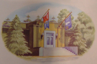
AMS WWII Headquarters Building (Brookmount, MD) The mission of the newly established Army Map Service was:
The new plant met a long felt need for a building in which work could be processed through in a logical and economical manner. All departments from drafting through photography, art work, plate making, press work, finishing and shipping were arranged within the plant in a manner to expeditiously handle all operations with a minimum of delay and interruptions to other departments. The Army designed the new plant especially for the peculiar needs of a map compilation and reproduction unit and during the planning process the proposed building was ample for the anticipated needs of the organization. However, subsequent to installing the initial equipment, the greatly increased wartime demand for maps dictated that additional space was needed for the Cartographic Division. Plans were immediately draw up for a temporary structure on the roof of the permanent building, known today as the Ruth Building, to house part of the drafting room and associated units. This temporary structure was completed in 1942 and, used continuously until the construction of another permanent building on the site in 1944. Also because of increased mapping requirements, the space allotted to the shipping department within the plant building became inadequate in 1943. To remedy this situation, several old temporary Civilian Conservation Corps buildings were reassembled outside the base plant building, to which the packing and shipping operations were relocated. In 1943, it became necessary to build an incinerator outside the base plant building for the destruction of classified waste. Prior to construction of the incinerator, the Washington city incinerator handled the destruction of classified waste, but this practice was not satisfactory from security and economical standpoints because of a fairly long haul in trucks through the congested areas of the city. Finally, in 1943 the Cartographic Division outgrew the base plant and some departments of the division were relocated to a building near the Fort Myers military reservation n Arlington, Virginia, approximately seven miles away. Although not considered remote, it was not considered ideal for efficient operation of the Cartographic Division and plans were made to construct a new permanent building as a distribution depot at the base plant property for housing of the Maintenance and Shipping Departments.
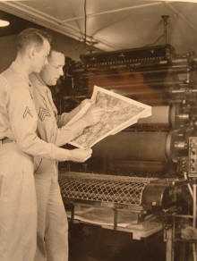
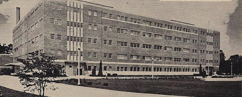
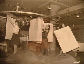
Left: Lt. McCaskill and Miss Cooperman check a shipping ticket for maps sent to theatres of operations. Right: Mounting aerial photographs taken in theatres of operations. In 1943, a new concrete masonry Map Distribution Depot permanent building, know today as the Warren Building, was constructed on the Dalecarlia site and provided an additional 48,400 square feet of much needed permanent space, replacing the three C.C.C. temporary buildings, which presented a constant fire and water hazard to the map stocks. The distribution depot was occupied in January 1944, but because of the ever increasing mapping workload even with that structure, space at Dalecarlia was inadequate. Accordingly, plans were made to add two new stories comprising 35,200 square feet to the depot building, which were constructed in 1945 for the ever growing stock of map items. In addition to the Dalecarlia site, the Army Map Service operated two warehouses in Arlington and at Cameron Station in Alexandria, Virginia, which stored reserve stocks of printed maps. Also in 1944, a twenty foot wide concrete roadway was built into the plant from MacArthur Boulevard just outside the Dalecarlia plant, and a new cinder base asphalt parking lot with a capacity of 275 cars was constructed. Also, a concrete side walk from the Dalecarlia Water Filtration Plant was extended approximately one-half mile to the Base Plant. Finally, in 1944, rotary saws were installed in the carpenter shop to speed the building of wooden map cases and enable the construction 350 cases per day during rush periods. The map cases were specially constructed so they could be readily converted to serviceable map shelves in overseas map depots. Because the plant consistently outgrew its space needs, the Bureau of Budget in March 1945 authorized funds for the construction of a five story building to provide 328,000 square feet of additional floor space. Congress approved the use $4.5 million of existing military funds for the construction of the building, and thirty-two acres were purchased for the building at Fort Sumner, Maryland, an historical Civil War outpost located approximately one-half mile west of the Dalecarlia Plant. Construction of the new building began immediately and was completed within a year.
New AMS Building |
|||||||||||||||||||||||||||||||||||||||||||||||||||||||||||||||||||||||||||||||||||||||||||||||||||||||||||||||||||||||||||||||||||||||||||||||||||||||||||||||||||||||||||||||||||||||||
|
IV. The Army Map Service's Wartime Map Making Workload The constant need for more facilities during World War II was a reflection of the ever increasing demand for maps as the war progressed. The below table gives a snapshot of the Army Map Service's wartime production figures.
(* Figures unavailable for 1942.) During the first year of the war the Cartographic Division expanded more rapidly than any other division as a result of the need for compilation and drafting for the revision of old maps and the construction of new maps. During that year many large projects for the compilation of air navigation, plotting, pilotage, and target charts were initiated. In addition, strategic and topographic maps of foreign theaters were started. Mosaics for the First, Second, and Third Army Maneuvers were completed as well the first edition of theater area indices. These indices were the Army Map Library's first attempt by to furnish interested organizations with information concerning the recent series maps covering approximately 60,000 sheets on file in the library. During the year, the services of the District Engineer, U.S. Lake Survey, Detroit, Michigan, were secured to directly supervise the operation of field offices in New York, Chicago, and Detroit for the compilation of Aeronautical Charts. The reproduction facilities of the Lake Survey plant in Detroit were also secured for the publication of these charts. To handle additional compilation and reproduction work, without commercial contracting, a large plant in San Antonio, Texas, was leased and operated under the immediate supervision of the Army Map Service. The old War Department Map Collection, which had been transferred to the Army Map Service a year earlier, became an integral part of the Army Map Service. Its activities in the procurement of manuscripts continued during the year. The branch library offices in Chicago, San Francisco, New Orleans, and New York City were placed under the technical supervision of the Army Map Library for accession purposes.
New York Office AMS As in other divisions of the Army Map Service, the Production Division was greatly expanded due to the enormous demand placed on it. Three 8-hour shifts were established to keep the presses running 24 hours a day, and the Cartographic Department operated on two 12-hour shifts. Notwithstanding the greatly expanded facilities upon moving to the new location, the equipment was insufficient to handle all work required of the Army Map Service. To meet the increasing requirements, commercial contracts for cartography and reproduction were negotiated with firms well equipped for the purpose and with whom the Army Map Service had established close technical relations. A complete survey of the entire lithographic trade was completed during the year and the facilities, equipment, and services of these commercial firms were analyzed for contingent use in emergency procurement of lithographic work. Commercial contracts accounted for approximately 20 percent of the Army Map Service's budget the first year.
Left: Checking the distance on a Japanese map. Right: Miss Stiddman points to area depicted in the enlarged lower map.
The activities of the Army Map Service kicked into high gear the second year of the war and is reflected by the Army Map Service budget's four fold increase from $4 million to $17 million over the previous year. During the second year, the cartographic activities performed at the Base Plant consisted primarily of work that had to be performed there because of security concerns or the urgency of completion required. Other than those projects, the activities of the Cartographic Department at the Base Plant were largely directed towards the planning and engineering of the overall mapping effort with detailed operations in large measure decentralized to other governmental agencies, commercial contractors, and the Army Map Service field offices outside the Washington area. Accordingly, the Base Plant devoted extensive efforts to the assembly of map coverage, map research, map design, preparation of specifications, computation of geodetic data, consultation while work was in process, and inspection of copy before release for reproduction. As a result, the Base Plant produced only 10 percent of new maps compiled and drafted by the Army Map Service, although the Base Plant performed all work involving the revision of existing maps.
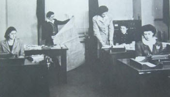
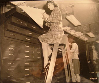
Left: Ms. Bonfield, on ladder, and Ms. Dellenger (center), and Ms. Repper filing finished maps in the map storage room. Right: Ms. Koehler filing maps in the map library. In February 1943, the Army Map Service established the Department of Field Cartography to provide additional cartographic capabilities without the necessity of expanding the Base Plant and overcoming the difficulties of recruiting skilled personnel to the Washington, D.C. area. The field offices accounted for 21 percent of the maps compiled and drafted by the Army Map Service during the second year. The following field offices were established.
The San Antonio Branch, which was established during the first year, handled both cartographic and reproduction work, and moved very quickly into production the second year. For the first part of the year, the Texas branch produced mainly domestic maps, charts, and miscellaneous publications, while later in the year this type of work was gradually reduced and assignments of a more urgent nature were given. San Antonio accounted for 13 percent of new maps compiled. The facilities of the Lake Survey continued to be confined to the compilation, revision, and reproduction of aeronautical charts. Specialization in this type of work made for efficiency and quick training programs for new personnel and accounted for 24 percent of the Army Map Service?s new maps workload. The Army Map Service also tapped into the capabilities of the U.S. Geological Survey, Tennessee Valley Authority, and Soil Conservation Service, which curtailed their domestic mapping activities, enabling them to assist in the more vital foreign map work. To supplement the activities of the Army Map Service, it entered into contracts with commercial companies well-established in compilation and drafting of topographical maps. These commercial companies maintained a nucleus of highly skilled technical personnel that added tremendously to the volume of production by the Army Map Service. During the year, commercial contractors accomplished 30 percent of new maps compiled and drafted by the Army Map Service, and overall production from these sources also resulted in approximately one-third of the total production of maps by the Army Map Service. Furthermore, commercial contractors performed 56 percent of the Army Map Service printing with the Base Plant performing 36 percent. The use of these firms also maintained a skilled commercial workforce for the duration of the war. This year the responsibilities of the Army Map Library were further established after conferences and agreement among representatives of the Military Intelligence Service, Office of Naval Intelligence, and the Office of Strategic Services and outlined in a joint directive issued in February 1943. This agreement provided that original maps, charts, and other materials of foreign areas obtained by any of these agencies and not already on file at the Army Map Service were to be forwarded to the Army Map Service. This established the library as the armed forces primary source of manuscript for topographic maps. Map accessions continued to increase during the year and in addition the library established new sections to catalog strategic engineering studies, monographs, handbooks, guidebooks, and general reference works. New map accessions during the year amounted to 227,117 sheets, with an average of 4,367 weekly.
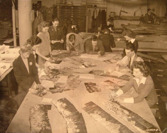
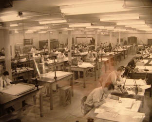
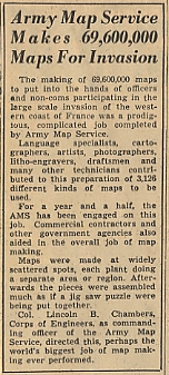
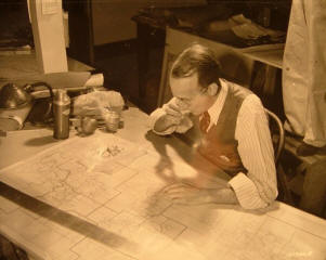
Left: The map drafting room. Right: Lt. Mast, AMS Executive Officer, confers with an employee examining foreign maps. Also, specific areas of geographic responsibilities were divided between the United States and Great Britain. On May 12, 1942, it was agreed that the U.S. would assume responsibility for all map production and supply for: North and South America, Australia and New Zealand, the Pacific Islands, Dutch East Indies, Japan, Iceland, Greenland, and Bermuda. The Geographic Section of the UK General Staff assumed responsibility for all other geographic areas. It was also agreed the Army Map Service and the British Directorate of Military Surveys would share with each other all maps reproduced so each headquarters would hold world coverage. At an international conference on March 10, 1943, it was further decided that the U.S. would additionally be responsible for Korea, Mongolia, Manchuria, parts of Russia and Africa, and China north of 32°N and east of 108°E. The U.S. also agreed to accept responsibility to prepare several specific maps of parts of Western Europe. During this second year, the Army Map Service?s combined operations shipped 54 million copies of maps, weighing 7.5 million pounds, prepared 2,971 new maps and revised 2273 old map sheets. In the third year of the war, the pace at the Army Map Service continued to accelerate, with the Army Map Service's budget increasing 65 percent over the second year, and the Army Map Service shipped 104 million copies of maps, prepared 4003 new maps (25% increase from the previous year), and revised 3424 of old maps (33% increase from previous year). The increase in the production of new maps greatly taxed the Army Map Service capabilities, as each new map required approximately 600 labor hours of cartographic effort. The Army Map Service continued to rely heavily on field offices, other government organizations and commercial contractors. During the year, the Army Map Service completed the preparation and reproduction of 69.6 million maps for the Normandy invasion.
Particularly noteworthy were the accomplishments of the US Geographic Survey and the Tennessee Valley Authority, who using multiplex equipment and combat aerial photographs stereo compiled a total of 518 sheets covering approximately 50, 000 square miles. Their output disproved the existing belief that it was impossible to apply stereo methods to produce military maps in time of war. Another particular accomplishment which began the prior year was the translation of 300,000 Japanese and 400,000 Chinese names into the Roman alphabet for use on maps of Japan and China. Three units of the Army Map Service employing 90 people of Japanese and Chinese descent were opened in Washington, Cleveland, and New York in March 1943, May 1943, and June 1944 respectively to perform this work. During the third year the percentage of work accomplished by various organizations supporting the Army Map Service's preparation of new maps was fairly consistent with that of the second year although the contractors' and Lake Survey's shares decreased slightly and other government agencies shares increased to 18 percent of the workload. As for printing, the Base Plant's and commercial contractors' press volume was fairly constant, although the San Antonio Branch's printing workload tripled in volume. The Army Map Service shipped 104 million maps, double that of the previous year. The Army Map Service's workload during the last year of the war was fairly consistent with the prior year. Although the number of old maps revised decreased slightly, the number of new maps produced increased proportionally. Much of the latter work was performed by the Army Map Service's field offices rather than the Base Plant. The overall press workload remained fairly constant, although the San Antonio Branch and commercial contractors assumed a greater share of the workload from the previous year. The number of copies of maps shipped by the Army Map Service increased by 65 percent to 172 million from the previous year; the increase representing the shipment of maps that were stockpiled in the warehouses the prior year. Cartographic work this year continued the trend which started in the prior year, and for the most part, was the production of new maps from basic sources rather than the revision or addition of grid and marginal information to existing maps. The new maps produced during this year were considerably more detailed and required greater productive effort than those produced in previous years. Accessions by the library increased 36 percent over the prior year.
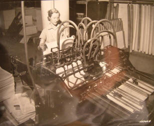
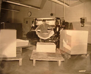
Left: Capt. Bruno and Lt. Col. Strobridge inspect a florescent map. Right: Map paper is run through a conditioning machine that removes moisture and prepares the paper to the proper temperature prior to printing. Two new divisions within the Base Plant were established in 1945: the Photogrammetric Division and the Geodetic Division. The Photogrammetric Division was responsible for: (1) all photogrammetric operations necessary to compile maps by stereo methods, (2) production of photo maps, and (3) photogrammetric research and development. Acquisition of equipment and training of personnel were the primary accomplishments of the new division during the year. Production was limited to one small project for the preparation of photomaps of an area of 140 square miles. The establishment of the Geodetic Division resulted from the physical transfer of the Geodetic Branch of the Corp of Engineer's Military Intelligence Division to the Army Map Service. The division was responsible for the performance of operational and staff duties relating to the procurement, analysis, maintenance, use, and dissemination of world wide horizontal and vertical control data; projection and military grid tables; miscellaneous geodetic and astronomical tables; and the computation of projections and grids required by mapping projects. E. The Year After The War (1946) Comparing 1946 with 1945 two items standout: decreased production and increased costs. These were largely the result of the cessation of hostilities and the readjustment of the post-war mapping program. Following VE Day the need for the preparation of overall large scale coverage in Europe disappeared, which materially affected the number of different maps prepared. Furthermore, the large press runs for individual maps substantially decreased. VJ Day had a similar effect for the Pacific area. Approximately 521 different maps in various stages of cartographic production were cancelled. A considerable number of sheets in planning and research that were scheduled for completion in 1946 were cancelled. Numerous contracts for reproduction were also cancelled as the need for the maps no longer existed. During this year, the Army Map Service closed the following five field offices: New York, Quincy, Indianapolis, Cleveland, and San Antonio. During the year after the war only 1,932 new maps were completed and 247 old maps revised. The number of maps reproduced deceased by 65 percent. The amount of money expended on new contracts decreased by 72 percent. The shipment of reproduced maps fell by 73 percent. The total funds expended by the Army Map Service decreased by 38 percent. The reason the funds expended did not decline proportionally was due primarily to a 20 percent pay increase approved by Congress for government employees, lump sum payments for accrued annual leave to employees resigning after the war, and the costs of training new person, replacing these departing wartime workers.
Left: Miss Leggett, a press operator, inspects a map for errors. Right: Mr. Bartley traces a new map from a source map using a map projector. In the library, most of the maps received during the year for accession were captured maps shipped from Europe and the Pacific areas. Although the end of the war naturally reduced immediate map requirements, the Army Map Service had come to maturity during the war and the Army Map Service's continuing worth was realized. This is evidenced by the fact that right before the war ended 5,015 map sheets were in production, and even with the cancellation of the a wartime maps, a year later 5,006 map sheets were in production. So the Army Map Service that had come of age during the war proven its continuing worth for peacetime. |
|||||||||||||||||||||||||||||||||||||||||||||||||||||||||||||||||||||||||||||||||||||||||||||||||||||||||||||||||||||||||||||||||||||||||||||||||||||||||||||||||||||||||||||||||||||||||
|
Colonel William A. Johnson Much of the accomplishments of the Army Map Service during the war were the responsibility of Colonel William A. Johnson, a veteran of WWI who commanded the Army Map Service from its days as the old Engineer Reproduction Plant until 1943 when he retired, and of Colonel Lincoln B. Chambers who replaced him and served until the end of the war. As the following table reveals, the workforce of the Army Map Service increased drastically during WWII.
(* Figures unavailable) Although military officers assigned to the Army Map Service were small in numbers, their contributions to the efficient operation of the Army Map Service should not be overlooked. Promotions were considered unsatisfactory and extraordinarily slow; many officers performed duties and held responsible positions which justified an increase of at least one grade over what they held. To perform these duties it was necessary to have a broad technical knowledge in specialized fields supplemented by a long period of practical experience. In fact, in 1944 over 70 percent of the officers were eligible for promotion based on their position assignments and duties and the length of time they had served in their present grades. In 1945, this situation was partially rectified by the promotion of 12 officers. The officer situation, however, was exacerbated by the 35 percent turnover rate and the fact that there were no experienced and technically trained officers available to replace many of those transferred. Only by changes in assignments within the organization and bringing in less experienced officer personnel replacements was it possible to continue without serious detriment to the overall operations.
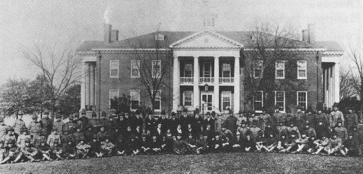
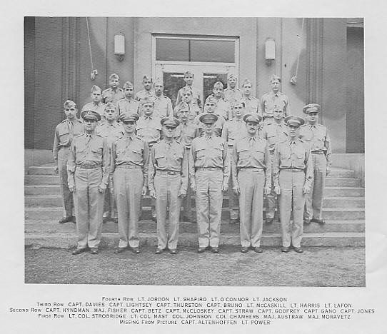
AMS Officers 1943 As could be expected, the increased demand for maps when the war began dictated a substantial increase in personnel needed by the Army Map Service and the recruiting of skilled personnel became increasingly more difficult. This difficulty in procuring skilled personnel for cartographic and reproduction work was partially in 1942 by the establishment of trainee programs at the Base Plant and in the various field offices under the supervision of the Army Map Service's Office of Education. A standard course of instruction, with accompanying lesson plans, was prepared for use by the instructors. In addition, the most likely qualified prospects were selected from Work Progress Administration (WPA) compilation and revision projects, operating under the Army Map Service field offices, as these activities were being gradually curtailed in the first year of the war. Selection of qualified technicians was made from these projects for War Service Appointments in order to retain the services of those who might otherwise have been lost in the generally increased demand for technically trained personnel.
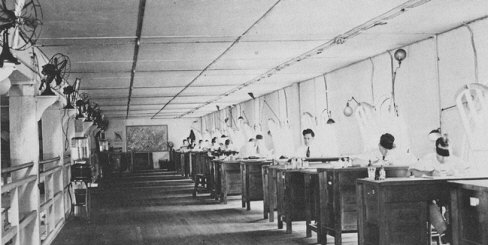
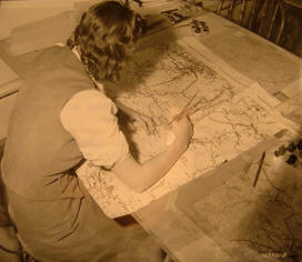
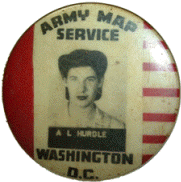
AMS Employee ID Badge The problem of replacing skilled compilers and draftsmen who were inducted into military service was initially met by the employment of female draftsmen, artists, and illustrators. These employees, who possessed artistic backgrounds, were trained in the performance of routine drafting tasks where comprehensive knowledge of cartography was not required. To further fill the need for skilled personnel, a course in military map making was developed and set up by Miss Edith Parker of the Geography Department at the University of Chicago. Miss Parker contacted the heads of leading women's colleges in the East and Mid-West to determine their suitability for teaching such a course. Likely colleges were selected and the 60-hour course in cartography was inaugurated upon approval by the US Department of Education and Civil Service Commission. Approximately 200 women were trained under this program and employed by the Army Map Service in 1942. Eventually, the military map making instruction was expanded to twenty-two universities. Obviously, a short course could acquaint the students with only the fundamentals of cartography. Therefore, a four-week "in-service" training course was set up to give these new employees practical experience they were unable to acquire as students. By giving the women this preliminary training the Army Map Service was better able to appraise their abilities and make appropriate work assignments to the following jobs: map library work, map research, map design, translation, computing, compilation, photomapping, drafting, and map editing.
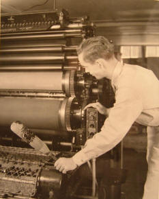
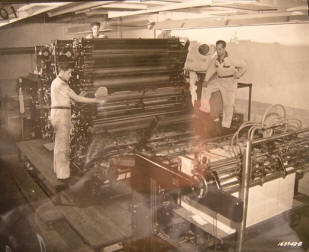
Left: Mr. Graziania inspects a printed map for errors. Right: Pressmen print a map in three colors. It was realized that many of these women had no cartographic training other than the 60-hour military map making course as most had majored in history, sociology, art, music, and other subjects not related to cartography. In spite of this lack of mapping background most of them developed into highly productive Army Map Service employees. The principle was thus verified that inherent intelligence combined with the willingness of the human spirit, especially in wartime, is of prime importance and that proficiency in a specified task automatically follows. Eleanor Roswell, a graduate geologist, headed a section in the map research group. Before the war an engineer officer filled her job. According to LTC Frederick Mast, executive officer of the Army Map Service, Roswell was "as dependable and faithful as any front-line soldier." Female employees were also trained in the operation of cameras, presses, and plate making and layout work. Some success was achieved in camera and layout work, however, in press operations, females employees were successful only in the operation of small presses where physical strength was not as important a factor. Plate making operations also called for physical strength in most operations and for this reason the use of females in this work was somewhat restricted. A formidable impediment to attracting qualified lithographers was the wide gap between government pay and that of private industry, which resulted in skilled lithographers preferring to work of higher paying private companies. To alleviate this situation, the Army Map Service prepared complete descriptions of all jobs in the lithographic art, in association with the US Geological Survey, Navy Hydrographic Office, Coast and Geodetic Survey, Weather Bureau, and Soil Conservation Service. The job classifications served as a basis for discussions which resulted finally in the adoption in 1945 of a pay scale comparable to that of private industry.
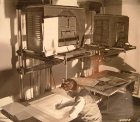
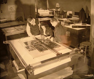
Left: Lt. Spurgeon with civilian employees, Mr. Kazlanekas and Mr. Webb, inspect the proof of a map before the plate is sent to the printers. Right: Mr. Lloyd moves printed maps to the storage room. Supplementing this training activity, local Washington, D.C. high schools were contacted and topographic drafting courses were established. This special instruction resulted in the procurement of 195 employees having a fundamental knowledge of the work prior to going on the Army Map Service payroll and was of immeasurable value in getting personnel into productive work quickly. Following the policy of the War Department, map making courses were also established at Walter Reed Hospital for returned veterans. Like the Army Map Service Base Plant, contractors lost many employees to the armed forces, not only unskilled help but valuable technicians as well. In many cases, despite these loses production was maintained by night and the use of administrative help to pack maps and do other unskilled labor. Addressing the rapid expansion of personnel during the war, especially the employment of females generally of 19 to 21 years old to replace employees inducted in the military serve, the Army Map Service established an Employee Relations Section. An experienced female employee was selected to head the section to handle many problems of the newly arrived personnel, such as housing, banking, and recreational facilities. Contacts with official housing authorities were supplemented by contacts with local citizens associations for the procurement of adequate housing for incoming female personnel. Many citizens in the local area, especially within the nearby Palisades area of Washington, D.C., rented out basements and other rooms in their homes to Army Map Service employees. Coordinated transportation plan were usually effective in providing transportation to and from local homes, although a large percentage of the women lived at Arlington Farms, having usually stood on two street cars and one bus before walking through the woods to the Base Plant. A credit union was even established within the Base Plant for the convenience of its employees. The success of the Employee Relations Section was immediately apparent in the high morale of the new employees.
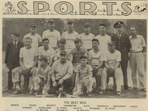
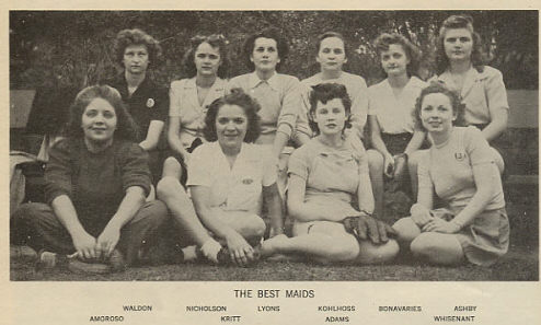
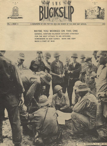
AMS 1943 Softball Teams The remoteness of the Base Plant from metropolitan recreation facilities demanded particular attention. The situation was remedied by sponsoring and encouraging male and female softball leagues in the summer months that proved a highly effective morale builder. The activities of bowling, tennis, golf, skating, and amateur photography also were aggressively pursued. Army Map Service employees even produced an occasional employee newspaper entitled "AMS Buckslip." A 1943 edition of the "AMS Buckslip" reports that ladies of the Army Map Service hosted a dance at the Statler Hotel for the men of Company B stationed at Fort Belvoir, who shortly thereafter reciprocated and hosted a dance at Ft Belvoir for the ladies.
AMS Buckslip Employee Newspaper During the war, many citizens considered working for the war effort a patriot duty and took employment at the Army Map Service. These patriotic souls generously gave their time to the war effort, their money to Army Map Service war bond drives, and their blood to the local blood bank. Some had temporarily left positions in private industry; others were wives or fiancees of men overseas. After VE and VJ Days, the majority of these people, having admirably fulfilled their patriotic duty, resigned and returned to their former activities. In the year after the war, the Army Map Service employed 731 WWII veterans, 260 who were former employees of the Army Map Service, to replace people who resigned at the end of the war.
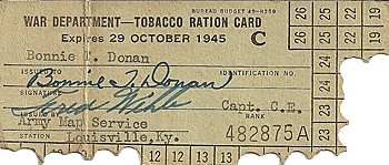
AMS Employeee Tobacco Ration Card |
|||||||||||||||||||||||||||||||||||||||||||||||||||||||||||||||||||||||||||||||||||||||||||||||||||||||||||||||||||||||||||||||||||||||||||||||||||||||||||||||||||||||||||||||||||||||||
|
VI. The Army Map Service Military Training School The Army Map Service Officers School was established on August 19, 1942 and operated for two years until it was suspended on April 1, 1944. The school was originally established for the purpose of instructing officers in map reproduction for field typographic units. Initially, it was assumed the officer students would already possesses some experience in map reproduction; however, it was quickly learned that most of the officers had no such experience whatsoever. Accordingly, the school courses included instruction in all phases of photography, plate making, press work and job planning. Considerable emphasis was given to the theory behind these subjects because the equipment and methods in the field unites varied considerable. Two different courses were given: (1) a 60-day course for students coming directly from Engineer Officer Candidate School and (2) a 30-day course for officers already assigned to field units. Seventy-three officer students attended the 60-day course during the war until the school?s close in 1944, although the Army Map Service hosted several military personnel from the Southwest Pacific Area (SWPA) in the spring of 1945 for a brief course in map reproduction. During 1944, the Army Map Service also provided instruction for small groups of officers and enlisted personnel in the operation of map depots for the distribution of maps.
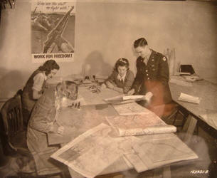
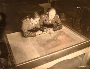
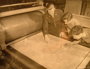
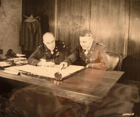
Col. Johnson, AMS Commanding Officer, plans a map project with Col. Loper, Chief, Intelligence Branch, Army Corps of Engineers. Right: Mr. Uhl at his drafting board. |
|||||||||||||||||||||||||||||||||||||||||||||||||||||||||||||||||||||||||||||||||||||||||||||||||||||||||||||||||||||||||||||||||||||||||||||||||||||||||||||||||||||||||||||||||||||||||
|
VII. Technological Advancements The use of untrained personnel required radical changes to map preparation technologies. An expert compiler or draftsman could not be made overnight so the varied operations were broken down into simple tasks, tasks which individually could be quickly mastered by novices, and the whole placed on an assembly line system. Many improvements in map design and advances in cartographic and photolithographic techniques were devised. These are too numerous to mention in detail, but some are worthy of special mention. The Army Map Service early in the war adopted the use of reflective projectors designed to reduce the laborious process involved in point-by-point plotting. The "alternate ban layer tint method" was developed, which simplified the preparation of gradient tint drawings to the extent that one drawing could be used for all the tints. It eliminated the necessity of separate drawings for each tint and assured perfect registration between the tints in printing. Further advances were made in mediums for map type for application to drawings adhesively, and commercially developed self-adhesive opaque and transparent mediums replaced the gummed stock. The new mediums allowed greater speed in application and proved more advantageous in revision and correction work. Composite color proofs of completed color separation drawings, developed commercially for the Army Map Service, expedited map editing. The expenditure of many man-hours in preparing overlays for color fit was no longer required. The use of blueline impressions on glass from reproduced negatives for drafting fill drawings--road classifications, open water, etc.--saved much time in drafting and editing and assured perfect color fit on the published map.
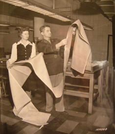
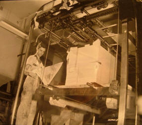
Left: Mr. Healy stacking maps after removing from paper cutter. Right: Mr. Grogan, Miss Thompson, and Lt. MacArthur working on a panel assembly of negatives from which press plates will be made. Fluorescent and "red-light" charts for use of night flying aircraft were developed and produced. Detailed map specifications were published that contained complete instructions through every phase of map preparation. A system of map identifications was set up and with minor modifications, the important elements of this system were adopted by a number of the mapping agencies of foreign countries. Finally, the Army Map Service investigated and found a suitable material, acetate rayon, for use in the production of cloth escape maps. |
|||||||||||||||||||||||||||||||||||||||||||||||||||||||||||||||||||||||||||||||||||||||||||||||||||||||||||||||||||||||||||||||||||||||||||||||||||||||||||||||||||||||||||||||||||||||||
|
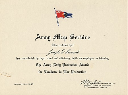
In summary, the Army Map Service employed over 3,500 persons during the war, supplemented its workforce with other government agencies and commercial contractors, allowing it to produce 500 million sheets during the war. More than 30,000 different maps of all types were prepared. The North African campaign alone required over 1,000 different maps with a total of 10 million sheets printed. The Normandy invasion required approximately 3,000 different maps with a total of 70 million sheets printed. Similar commitments were filled for the Pacific and the Far East military theaters. For its contributions to the war effort, the Army Map Service for awarded the Army-Navy Production "E" for excellence award for outstanding services in the production of war equipment, which was symbolized by display of the "E" flag at the Base Plant. The Army Map Service was authorized four white stars on the flag representing five consecutive renewals of the award during the war. The employees of the Army Map Service were rightfully proud of their contributions to the war effort. Any military person will readily confirm that an accurate map is essential to the success of any military operation.
AMS Employee Army-Navy Production "E" Award Pin & Certificate (1943) |
|||||||||||||||||||||||||||||||||||||||||||||||||||||||||||||||||||||||||||||||||||||||||||||||||||||||||||||||||||||||||||||||||||||||||||||||||||||||||||||||||||||||||||||||||||||||||
|
The Army Map Service was retained after World War II and became the U.S. Army Topographic Command in 1972. It later became part of the Defense Mapping Agency in 1972, which became part of the National Imagery and Mapping Agency in 1996, whose name was changed in 2003 to its present name, the National Geospatial-Intelligence Agency (NGA). NGA continues a proud tradition of providing maps and geospatial intelligence to the military services and other federal agencies.
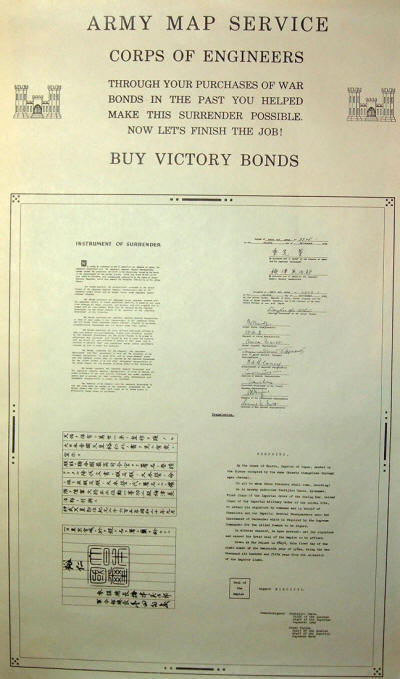
AMS Employees Buy Victory Bonds Poster The above textual information was derived from: 1. The Army Map Service, 1952, a publication of the Army Map Service, Washington, D.C. 2. Official Annual Reports of the Army Map Service for fiscal years 1942-1946. |
|||||||||||||||||||||||||||||||||||||||||||||||||||||||||||||||||||||||||||||||||||||||||||||||||||||||||||||||||||||||||||||||||||||||||||||||||||||||||||||||||||||||||||||||||||||||||
|
|
|||||||||||||||||||||||||||||||||||||||||||||||||||||||||||||||||||||||||||||||||||||||||||||||||||||||||||||||||||||||||||||||||||||||||||||||||||||||||||||||||||||||||||||||||||||||||
|
© Copyright 2008. All rights reserved. |
|||||||||||||||||||||||||||||||||||||||||||||||||||||||||||||||||||||||||||||||||||||||||||||||||||||||||||||||||||||||||||||||||||||||||||||||||||||||||||||||||||||||||||||||||||||||||

 The want of accurate maps...has been of grave disadvantage to me. I have in vain endeavored to procure them, and have been obliged to make shift with such sketches as I could trace out from my own observations and that of gentlemen around me. I really think if gentlemen of known character and probity could be employed in making maps (from actual surveys)...it would be of the greatest advantage.