History of the Aeronautical Chart Service |
|||||||||||||||||||||||||||||||||||||||||||||||||||||||||||||||||||||||
|
Table of Contents
|
|||||||||||||||||||||||||||||||||||||||||||||||||||||||||||||||||||||||
|
I. The Advent of Air Navigation Charts in the US From the time of the momentous first flight of the primitive "Kitty-Hawk" down through the years to the cessation of hostilities of World War I, pilots and navigators plotting their courses from engineer ground maps or any other available information and were entirely dependent on their knowledge and familiarity with the terrain over which they were navigating. Such practices obviously created severe obstacles to safe and efficient air navigation, which greatly retarded the use of planes for night flying during inclement weather and periods of low visibility. These obstacles, history divulges, together with the primitively constructed airplanes of that era were instrumental in the considerable loss of life among the pioneer pilots as well as the destruction of their aircraft. It is difficult for most people today to realize that the allied air forces (and those of Germany) participated in air operations and strategic bombing throughout World War I without the aid of aeronautical charts. Even as late as 1923, there were neither air navigation maps nor charts published in the United States for the use of aviators. The few maps that were available and could be used for pilotage were of the following types: (1) nautical charts of coastal areas published by the Coast and Geodetic Survey and the Hydrographic Office of the U.S., (2) Geological Survey state maps, (3) Post Office Department route maps, (4) Rand McNally state maps, and (5) National Geographic Society map. None of these maps or charts contained any aeronautical information. The Library Section of the Information Division of the Air Service, both units having been organized about 1920, was responsible for the issuance of these maps to the Army Air Service. The Information Division was under the jurisdiction of the Chief of the Air Service and consisted of approximately one hundred and twenty-five civilians and twenty-five officers, of which the Library Section contained twenty civilians. The functions of the Library Section consisted of the maintenance of a book library, involving subjects of interest relative to the Air Service, and the procurement and interspersion of maps. The maps furnished for the first round-the-world flight by Major Frederick L. Martin and his associates (who took off from near Seattle on April 6, 1924) were Hydrographic charts pasted on cloth and cut into strips on which flight lines--with the mileage scales and magnetic variations plotted--had been hand-drafted. This process required the services of two draftsmen for several months to plot the information on the charts. It is interesting to note that the flight was made in four Douglas World Cruiser biplanes--the Seattle, Chicago, Boston, and New Orleans. One hundred and seventy-five days later, two of the original four planes returned, completing the first round-the-world flight in aviation history. America had succeeded where Great Britain, Italy, Portugal, France and Argentina had failed.
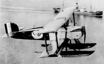
Douglas World Cruiser Chicago About this time that airports and landing fields were being constructed, and in order that proper records might be maintained of these locations, the Training and War Plans Division of the Army Air Service formed the Airways Section in approximately 1922 for that specific purpose. This Section's principal duties consisted of compiling information which related to the establishment of military air routes, the determination of locations for radio aids to navigation, and the preparation of airport bulletins and listings of airports in the United States with sketches of the principal airports as exhibits, which were four by six inches in size. On 20 April 1923, the Airways Section forwarded a letter to the Army Chief of Engineers, furnishing a set of standard specifications and authorizing the Engineer Reproduction Plant to compile a series of Air Navigation Strip Maps, Numbers 27 to 35, at a scale of 1:500,000. These specifications were very similar to those used later for WWII aeronautical charts and listed the types of symbols to be used, colors desired and other specific data. However, these strip maps varied in length, depending upon the amount of terrain covered between the principal points along Army air routes, which would, in turn, depict a variance in mileage. On the other hand., the width was always the same, embracing eighty miles which, at a scale of eight miles to the inch, gave the strip map a width of ten inches. At approximately the same time the Army Engineer Reproduction Plant (subsequently the Army Map Service) was contracted, and the Geological Survey of the Department of the Interior also was given a contract for the compilation and reproduction of the first eighteen of these strip maps. The letting of these contracts was made possible by the Chief, Information Division, who requested an allocation of fifteen thousand dollars, which sum was made available by the Air Service and was authorized by General Richard H. Patrick, Chief of the Air Service, in 1923.
The allotment resulted from the realization that it was a military necessity to provide suitable aviation maps or charts to promote efficient operation of all military aircraft. These strip maps were made available at a cost of thirty-five cents each and were not returnable. Provision was made, also, that if purchased in lots of twenty or more in one shipment to one address they could be procured at a cost of twenty-five cents per copy. The distribution of these strip maps as they became available--along with other miscellaneous types of maps and informative media previously mentioned--was handled by the Library Section of the Information Division. As of July 1926, thirty-three strip maps had been published, and twelve more were in various stages of compilation. The average cost for the compilation, reproduction and distribution of each of these aviation strip maps was two thousand dollars. |
|||||||||||||||||||||||||||||||||||||||||||||||||||||||||||||||||||||||
|
II. Formation of a Charting Agency During this production period strong arguments were propounded for the formation of a civilian agency which would have responsibility for correlating aeronautical matters between the mapping reproduction agencies and the military air arm. This eventually led to the establishment of the Bureau of Air Commerce in the Department of Commerce, which was accomplished by the passing of the Air Commerce Act of 1926, and later approved by President Coolidge in his annual message to Congress. In August 1926, President Coolidge appointed Mr. William P. MacCracken as Assistant Secretary of Commerce for Aeronautics. The Senatorial Report accompanying the petition for the Air Commerce Act of 1926, which stated in part: The Secretary of Commerce will under this bill be authorized to direct the Coast and Geodetic Survey, to provide as adequate charts for air navigation as it now provides for ocean navigation. No one would think of attempting to take an ocean vessel into unfamiliar waters without a good chart, one which indicates obstructions to navigation as well as safe channels and the whereabouts of beacons and lighthouses. Nevertheless, air pilots are expected to navigate aircraft in most cases without adequate charts. No one begrudges the expense to which the United States Government has been put in the preparation of its coast-wise charts, and no one should begrudge to the Airmen the expense necessary in providing him with similar aids to navigation. In the Army Air Service one of the most important sections created as a result of the advent of the new Bureau of Air Commerce was the Airways Section. The functions of the Airways Section of the Training and War Plans Division were the procuring and furnishing of information about airport locations and the checking of proof copies of compiled strip maps as they were released from the mapping agencies. This section encountered considerable difficulty in performing the latter function of proof checking. It was decided the most efficient method for checking these strip maps would be actual flight checks conducted by pilots. As a result of this decision, arrangements were made to forward the proof copies, as they became available, through the corps area commander to the nearest air service activity, requesting that flight checks be made and a report be tendered by the pilot as to his findings. The proof copies were then returned to the map reproduction agency with notations of existing errors and/or any recommendations for correction. As strip maps were completed and forwarded for distribution, there arose a strong demand private pilots and commercial companies. To meet this need, arrangements were made through the Book Department at Fort Humphreys, Virginia for the sale of these strip maps, and in February 1927, Major R.L. Walsh, Chief of the Information Division, requested the quantity of all strip maps printed by the Engineer Reproduction Plant be increased to four hundred copies. The total funds allocated to the Air Service for maps and charts were broken down into two categories: (1) compilation and drafting, and (2) purchase of printed maps. The appropriations for compilation and drafting amounted to approximately eighteen thousand dollars per year, and it was from this fund, made available each fiscal year, that provision was made to defray the cost of the printing of strip maps. The Air Service produced a series of fifty-two strip maps covering the routes to be flown by military aircraft, and the Coast and Geodetic Survey in September of 1927 began the compilation of additional strip maps which were not covered by the Air Services series, but consisting of routes to be set up for commercial operations. The Coast and Geodetic Survey requested that the Air Service have this series flight checked. Lieutenant Isiah Davis, of the Air Corps, was assigned as Flight Check Officer, and on April 5, 1928, instituted the flight check of five of the new strip maps. As of May 1928, the Air Service, which by this time was known as the Army Air Corps, had published thirty-eight air navigation strip maps. On May 10th, Major Ira Longanecker, who became Chief of the Information Division, was advised that the total funds available for Fiscal Year 1928 amounted to $47,500 and was to be used for books, maps, educational equipment and supplies.
On December 15, 1928, map procurement and distribution were removed
from the Library Section and transferred to a separate unit called
the "Map Unit" under the Chief of Information Division located in
the Munitions Building, which housed the War Department. This
new unit was led by a civilian, Mr. L. P. Brown, accompanied by two
assistants: a clerk stenographer and a junior clerk. The
unit was responsible for the procurement and dissemination of the
fifty-one air navigation strip maps that were then available and a
number of miscellaneous maps and charts of the United States and
foreign countries, and also the compilation and distribution of
airport information in semi-monthly publication. This unit was
further responsible for the preparation and assembly of all maps and
charts that were required for specific flights by pilots assigned to
the Office of Chief of Air Corps. All activated Air Corps in
the United States received their distribution of maps and charts
from the Map Unit. Cooperating with other mapping agencies between
1928 and 1935, the Map Unit procured U. S. Sectional Charts, U. S.
Regional Charts and Rand McNally Aviation Maps, and prepared various
publications relating to maps and charts. In January 1929, a committee on "Air Navigational Maps," appointed by the Board of Survey and Maps of the Federal Government, recommended that sectional air navigational charts be prepared covering the entire United States. In February 1929, Rand McNally printed a series of Air Trail State Maps, which contained a red overprint of airport information and showed isogonic lines. In spite of the fact that these Air Trail Maps were compiled at different scales and provided very meager aeronautical data they proved to be quite popular, and the Map Unit ordered thousands of copies in response to requisitions from Air Corps activities. A special experimental map project was approved in July 1930, authorizing the compilation and production of an air navigational strip map from aerial photographs. This experiment was successfully completed, and the first aerial strip map was completed in 1931; it covered the route between Wheeling, West Virginia, to Richmond, Indiana, and was forwarded to Wright-Patterson Field, Dayton, Ohio, for their inspection and report thereof. During November 1930, the Chief of the Information Division requested the Training and Operations Division to provide a YP-l airplane and that it be equipped with a drafting board and special instruments to be used for flight checking the strip maps. Lieutenants Harold G. Peterson and Alvin F. Maughan were assigned to accomplish the flight checking and shortly thereafter proceeded to the west coast to flight check four air navigational strip maps. The YP-l airplane was a photographic plane modified at Wright-Patterson Field to permit the taking of photographs by hand and also included a table especially constructed for laying out of the air maps being checked. These modifications were personally supervised by Lieutenants Peterson and Maughan. Sometime in April 1931, Lieutenant Peterson submitted a report to the Chief of Information Division regarding the flight check of air strip maps and recommended that a standard procedure be followed for all future checks. Lieutenant Peterson suggested that the strip maps being checked be ruled off into ten mile strips and that flight checks be made by flying up and down the ten mile strip; posting corrections in colored inks; and photographing unusual conditions and landmarks. The purpose of this recommendation was to implement a systematic method to be used by all pilots assigned to flight checking aerial strips so that the checked strips would be uniform in pattern and construction. The recommendation alluded to was adopted and put into operation and lasted about two years, after which time both lieutenants were transferred and no further flight checks were undertaken by the Information Division, Army Air Corps. It should be stated that the strip maps referred to in the foregoing paragraphs were compiled and printed by the Engineer Reproduction Plant, later known as the Army Map Service, in accordance with specifications furnished by the Air Service. The Information Division was responsible for forwarding of these charts to the Air Service for flight check and the reports tendered on completion of the check. |
|||||||||||||||||||||||||||||||||||||||||||||||||||||||||||||||||||||||
|
In December 1930, the Department of Commerce informed the Chief of Air Corps that a new series of air navigational charts, to be known as "Sectional Air Navigational Charts," were being prepared by the United States Coast and Geodetic Survey. The announcement issued by the Coast and Geodetic Survey of these new charts stated:
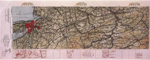
Sectional Airway Map No. L-14 Fargo, North Dakota (August 1935) In June 1933, General Benjamin D. Foulois, Chief of the Air Corps, in a letter to the Department of Commerce agreed to eventually cancel the Air Corps strip maps and instigate the use of the Department of Commerce Sectional Charts produced by the Coast and Geodetic Survey because the strip maps possessed two primary disadvantages: (1) a very narrow range coverage of only eighty miles, and (2) due to this limited range, pilots digressed from the boundaries of the strip maps and were dependent upon adjoining sheets for their ultimate destinations, which necessitated carrying numerous strip maps for prolonged flights.
General Benjamin D. Foulois September of 1933 saw Lieutenant Colonel W. R. Weater appointed as Chief of Information Division by the Personnel Section, Headquarters, Army Air Corps. In July 1934, the Information Division authorized the compilation and printing of an experimental strip chart between Washington, D.C., and Boston, Massachusetts, No. 63, on a scale of 1:750,000, on which a night flight map was printed on the reverse side. This night flight map, so far as can be ascertained, was the initial attempt to provide a map suitable for reading under artificial light in the cockpit of airplanes during night flying. The information was printed in red and under a white light looked almost black. No form of fluorescent ink was used for this type of illuminated map. Eighteen thousand dollars was provided in fiscal year 1935, with the stipulation that the amount to be used for the revision and compilation of Army Air Corps air navigational charts. During the month of February 1935, Lieutenant Colonel J. D. Reardon was appointed Chief of the Information Division and, while in office, was responsible for considerable research. One of these studies, assigned to and carried out by the Map Unit, consisted of classifying all airports in the U. S. according to their suitability for use by light, medium or heavy aircraft, thereby enabling a pilot to ascertain the landing facilities at an airport prior to his arrival. During the latter part of 1935, Air Force activities consisted, generally, of requisitioning not only air navigation strip maps, sectional aeronautical charts and Rand McNally aviation maps, but also Hydrographic Office charts and other miscellaneous maps. There appeared to be no distinct preference shown for any one special type of aeronautical chart; therefore, in order that a comprehensible standard policy might be set up for the procurement and issuance of appropriate air navigational charts for the specialized needs of the Air Corps, a Board of Officers was appointed. The board met with the Chief of the Information Division for the purpose of formulating and recommending policies and procedures for the procurement and dissemination of air navigational maps. After careful deliberation the board advocated the abolishment of Air Corps strip maps and that the U. S. Sectional Charts, published by the Coast and Geodetic Survey, be utilized in the compilation of a series of Air Corps Map Books, covering principal routes flown by military aircraft. A considerable number of these map books were contracted for through the Chief of Engineers and were distributed to Air Force activities all over the U. S. The popularity of these books was very marked; however, despite this fact, the printing was discontinued because they were labor intensive and accordingly expensive to produce. In July 1936, Lieutenant Colonel H.H.C. Richards was appointed Chief of Information Division, Army Air Corps. The Chief of the Air Corps, in a letter to the Adjutant General dated June 1939, requested that a project for the compilation of Mercator charts of the U. S. be authorized and that funds be included in the 1941 budget for $49,860 to be made available in fiscal year 1941 and $57,150 in fiscal year 1942. Lieutenant Colonel R. C. Candee was appointed Chief of the Information Division in October 1939, and shortly thereafter the Map Unit was redesignated as the "Map Section" and placed under the jurisdiction of a commissioned officer. With the advent of war becoming more imminent the Map Section began to expand, and a directive was issued to formulate plans and specifications for the procurement of additional aeronautical charts in various world theaters that previously had not been covered by air navigational charts. In pursuit of this program an almost unbelievable condition was disclosed: only ten percent of the earth's surface had been adequately mapped, and even this small percentage had not been maintained--this meaning that although the areas had been mapped at some time or another, the nation's engineers and cartographers had not revised the maps in response to later up-to-date surveys. Very little, if any, information was indicated on the older maps regarding radio stations, airway beacons and other similar items that were critical to air navigation. During January 1941, the Information Division?s name was changed to the Intelligence Division A2 and was commanded by Lieutenant Colonel J. G. Taylor. By the end of 1941, the Map Section had increased its personnel to twenty officers and civilians. In February 1941, the Chief, Intelligence Division, in compliance with a directive from General H. H. Arnold, Chief of the Air Corps, to formulate plans for additional aeronautical charts covering world areas, contacted the Coast and Geodetic Survey and requested that a new series of aeronautical charts immediately be prepared and designated as the Western Hemisphere Aeronautical Charts at a scale of 1:1,000,000. In July 1941, the Chief, Intelligence Division, in a letter to the Chief of Engineers requested the Engineer Reproduction Plant to proceed immediately with the compilation of World Long Range Charts at a scale of 1:3,000,000. Total funds available were $148,860; however, another $2,333,150 were provided for Fiscal Year 1942, which were deemed adequate for these new projects. A conference of officers from various Air Corps offices held in August 1941 established the need for a World Planning Charts Series. On September 14, 1941, specifications and layouts were forwarded to the Coast and Geodetic Survey requesting cost estimates for the preparation of this series. The series consisted of forty-three sheets, scale 1:5,000,000, and was given to the Coast and Geodetic Survey for compilation in November 1941. By the end of the year, compilation on thirty-four sheets had been completed; nine of these had been edited, but only one had been reproduced and delivered. At the close of calendar year 1942, twenty-three additional sheets had been edited and nine more printed and made available. Despite the fact that twelve sheets in the Arctic and Antarctic areas had been "frozen" for several months because of objections voiced from contributing mapping agencies, production of the balance was accomplished by the end of February 1943. In October 1941, requirements were established for a series of Outline Charts covering the world which depicted for climatological recordings. The scale was 1:5,000,000, and the sheet break arrangement was the same as the World Planning series. By November 1941, the Map Section assigned the task of compilation and reproduction to the Coast and Geodetic Survey and by June 30, 1942, twenty-one sheets had been printed and delivered with an additional nine to be delivered at the close of the calendar year. At that time the Air Forces recognized a need for other weather plotting charts covering localized areas at various scales and projections. Historical records, although somewhat vague and incomplete, indicate this series also was assigned to Coast and Geodetic Survey with a production record of twenty-three sheets printed and delivered by the end of 1942. The Map Section had been forced to relocate three times within the Munitions Building and finally in November 1941 established permanent quarters at Bolling Field, Washington, D. C. |
|||||||||||||||||||||||||||||||||||||||||||||||||||||||||||||||||||||||
|
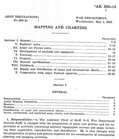
After December 7, 1941, with the entry of the U. S. into World War II, the requirements for worldwide coverage of aeronautical charts catapulted to a position of major importance; consequently, in January 1942, the Map Section was removed from the jurisdiction of the Intelligence Division to the Air Traffic Services and renamed the Map-Chart Division. Army Regulations 300-15, dated May 1, 1942, titled "Mapping and Charting," and Army Air Force Regulations 95-1, dated May 15, 1942, titled "Photography, Maps and Charts," regulated the unit's responsibilities. The Map-Chart Division was charged with the preparation, procurement, compilation, reproduction, maintenance and general distribution of aeronautical charts. It was obvious that the small, newly organized division could not recruit a sufficient staff or acquire adequate facilities to meet the needs of the Air Forces; nor was it believed necessary, because several other existing governmental agencies were capable of meeting much of the Air Forces requirements. Therefore, the Map-Chart Division was organized primarily as a control agency within the Air Forces to manage work performed by other agencies operating under contracts with the Air Forces.
Army Regulation 300-15, Mapping and Charting (May 1, 1942) Every available government mapping agency was contracted, and arrangements were made to integrate their resources. Thus, the partial facilities of the Army Map Service, Corps of Engineers, with its eight subsidiary offices were secured, as were those of the Coast and Geodetic Survey with its six branch offices, the Alaskan and Topographic branches of the Geological Survey and five branches of the Department of Agriculture, together with thirty-five or forty of the best known commercial organizations, making available to the Air Force the services of approximately 5,000 cartographers and lithographers for the accomplishment of one of the most extensive charting programs up to that time. By March 1942, total personnel of the Map-Chart Division had increased to 142 civilians and 42 officers. The funds available in the fiscal year 1943 amounted to $9,408,434, and the World Aeronautical Charts, at a scale of 1:1,000,000, covering all land areas of the world, were authorized. As production on this tremendous charting program commenced, examination of existing source material revealed that reliable map information did not cover an astonishingly high percentage of the world?s land areas. To remedy this serious situation, the Army Air Forces initiated the most extensive program of aerial photography ever attempted. This photography was to be accomplished by the Trimetrogon System--a system that employed the use of three cameras: one pointed vertically downward in the conventional manner; the other two were mounted obliquely, pointed in opposite directions, perpendicular to the line of flight. The two obliquely mounted cameras were placed to photograph both horizons and a small part of the area covered by the vertical camera. From these aerial photographs, planimetric and topographic compilations were made for photogrammetric bases, preliminary bases, recompilation overlays and mosaics. In a memorandum to Commanding General, Army Air Forces, dated of November 19, 1942, entitled "Difficulties in the Production of Aeronautical Charts," Col. N. V. Kaye, Director of Photography, described the Map-Chart Division organization and contractual agencies as follows: The first mapping group is composed of 4 squadrons equipped and trained to accomplish aerial photography from which maps and charts are compiled. ... [D]uring the past year 2,000,000 square miles of photographs through unmapped and unsurveyed regions of the world had been accomplished and that 1,000,000 square miles of these photographs had been compiled by the newly developed Trimietrogon method and incorporated into aeronautical charts. Over a four-year period more than 10,000,000 square miles of photography were accomplished, making available source material reliable for the compilation of aeronautical charts. The importance of the charting program was emphasized the following day, November 20, 1942, when General H. H. Arnold, Commanding General, Army Air Forces, in a letter to the Commanding General, Materiel Command, on the subject of the procurement of photogrammetric and cartographic equipment stated: [T]hat the production and supply of aeronautical charts, required to guide our Air Forces to and accomplish their mission at objectives is of extreme importance and in order to properly perform this highly technical work, the required equipment should be procured as rapidly as possible.
General Hap H. Arnold The undertaking of a project as extensive as this worldwide charting program was beyond the production capacity of any one agency. Accordingly, the Army Air Forces was forced to utilize by contract agreement the coordinated efforts of all governmental mapping and charting agencies and commercial drafting companies. Upon completion of this program, more than 6,000 individual charts had been printed and more than 100,000,000 copies overprinted with air information were made available for distribution. More than 5,000 people were engage in this contract work at its peak. Digressing back for a moment to early 1941, it should be noted that one of the problems facing the Air Forces was the type and scale of charts required for this worldwide chart endeavor. Probably the earliest decisions were the previously mentioned Western Hemisphere series compiled by the Coast and Geodetic Survey and the World Long Range series undertaken by the Army Map Service. After holding numerous conferences with other Air Force activities and reconciling differences of opinions, requirements for the Air Forces for the following charts were established by the end of the year: (1) World Planning, 1:5,000,000 scale; (2) World Weather Charts, 1:5,000,000 scale; (3) World Long Range Navigation, 1:3,000,000 scale; (4) World Aeronautical Pilotage Charts, 1:1,000,000 and 1:500,000 scale; (5) Approach Charts of Strategic Areas, 1:250,000 scale; and (6) Target Charts of large scale. Charts of these general series were being produced by the contracting agencies and were being compiled from the best source material available. The ever increasing demand of the Air Forces necessitated an all out production effort to provide something even at the expense of accuracy. The coordinated efforts of the contracting agencies were not without headaches. Each of the agencies had its own way of doing things peculiar to its operation. Security, priorities, special and rush jobs all contributed individual problems. An example the sheet size to be used in the World Aeronautical Charts, scale 1:1,000,000. The Western Hemisphere series was being produced on sheets thirty-two inches by forty-six inches, and after the reproduction facilities of the Army and other governmental and commercial agencies were analyzed, it was decided to change the sheet size to twenty-two by twenty-nine inches. There were three main contributing factors: (1) the convenience of the smaller chart size within the confined space of an airplane?s cockpit, (2) the ability of field press equipment to reproduce the smaller size, and (3) the fact that this size made available many additional printing facilities. This change was resisted by Coast and Geodetic Survey to such an extent that the Commanding General, Army Air Forces, had to intervene. The distributing facilities of Map-Chart Division at Bolling Field soon became inadequate because the volume of charts produced outpaced available space. The growing Army Air Forces were opening centers throughout the nation; and to accomplish the chart distribution functions stipulated in AR 300-15, it was decided that a decentralized supply system be established. Working through the Corps of Engineers Real Estate Division, efforts were made to find locations suitable for distributional stores. In March 1942, quarters were leased at 1222 22nd Street, N.W., Washington, D. C., for the creation of a Base Store, and soon thereafter the stocks of charts and the distributing activities were removed from Bolling Field to the newly acquired location. In the following months, substations (or as they later became known--Regional Stores) were set up in St. Louis, Missouri; Atlanta, Georgia; San Antonio, Texas; Oakland, California; and Spokane, Washington. Stocks were shipped to these Regional Stores by the Base Store in Washington, D. C. By June 1942 most of these field stores were ready to function. In May 1942, the first edition of the Catalog of Aeronautical Charts and Related Publications was issued. This catalog illustrated the distributing system and indexed the aeronautical charts then in work as well as those which had been published. It also indicated publications of other agencies carried in stock which included reproductions of British, French, Canadian and Australian charts as well as the publications of Hydrographic Office, Coast and Geodetic, Geological Survey and others. In June of 1942, the Map-Chart Division was moved from Bolling Field to Gravelly Point, Alexandria, Virginia, with a forced interruption to work and production of some 1,200 man-hours. On June 30, 1942, the Map-Chart Division employed 142 civilians and 42 officers. Allotments for fiscal year 1942 amounted to $3,108,130. |
|||||||||||||||||||||||||||||||||||||||||||||||||||||||||||||||||||||||
|
A review of the work load in fiscal year 1942 indicates the following projects were undertaken and in partial states of completion: (1) In February 1941, the Western Hemisphere series, scale 1:1,000,000 was initiated. Sheets IM through 17M (U. S. coverage) were already available as the U. S. Regional Charts which were published by the Coast and Geodetic Survey. The additional 103 sheets were assigned to the Coast and Geodetic Survey for compilation. By the end of 1941, thirty-four of the sheets had been processed through final editing and twenty-five sheets had been reproduced. At the end of the fiscal year (June 30, 1942) editing had been completed on 9 additional sheets and reproduction finished on 35 additional sheets. A total of 77 of the 120 sheets were available after 17 months. (2) In July 1941, the World Long Range Air Navigation series, scale 1:3,000,000 was assigned to the Army Map Service. This series consisted of 78 sheets. A year later at the end of the fiscal year, 41 sheets had been printed and delivered to the Base Store, the balance being completed and delivered by the close of 1942. (3) On September 17, 1941, specifications and layouts for the World Planning Charts series were forwarded to Coast and Geodetic Survey for estimates. This series consisted of 43 sheets at a scale of 1:5,000,000. No work was contemplated on Sheet 9W, the U. S. Area, as the Coast and Geodetic Survey chart 3060B at the same scale and projection was already available. By the end of fiscal year 1942, compilation had been completed on 34 sheets; 9 of these had been edited and only 1 had been reproduced and delivered. At the close of calendar year 1942, twenty-three more charts had been edited and 9 more printed and delivered. While reproduction of the balance was accomplished in January and February of 1943, there were 12 sheets in the Arctic and Antarctic areas which were suspended for several months due to objections of other agencies over names that were to be used in these areas. (4) In November 1941, the Outline Chart series was assigned to the Coast and Geodetic Survey for compilation and reproduction, and by June 30, 1942, twenty-one sheets had been reproduced and delivered with 9 more being delivered by the end of the calendar year. The Coast and Geodetic Survey?s chart 3060 was likewise used in place of 9W, and 8 of the Arctic and Antarctic sheets were held up. (5) Somewhat vague and incomplete historical records indicate the World Aeronautical Pilot Charts were assigned also to the Coast and Geodetic Survey with production records showing 23 sheets printed and delivered by the close of 1942. World coverage of aeronautical charts at 1:1,000,000 scale had been established as a definite requirement for pilotage. However, in the interim, available maps were being employed as a stop-gap measure, pending the design and sheet size arrangements of a complete World Aeronautical series. In addition to the World Hemisphere series, certain British publications of Europe and Africa, Canadian charts and other foreign productions were available for spotty coverage. A carefully considered plan for the World Aeronautical Charts was crystallizing in the latter part of 1941. (6) Coverage of Japan at usable scales was totally lacking, and following the declaration of war in December 1941, the Army Map Service was assigned the compilation of aeronautical charts of Japan at 1:500,000 scale. The sheet breakdown and numbering was the same as with the 1:1,000,000 charts. Obviously this was a "must" project. In March and April 1942 compilation of the 72 sheets had been completed and drafting began. Blueline bases were delivered for plotting the aeronautical overprint beginning in May, and all were returned by the end of August with the result that the 72 completed charts were delivered to the Base Store by the end of October 1942. (7) In February 1942, a satisfactory arrangement of sheets for the World Aeronautical Charts, scale 1:1,000,000, was decided upon; this series comprised a total of 1,844 sheets. Approximately 950 sheets covered the land area. The requirements for water areas was not firmly fixed, and immediate consideration was given to only a few water charts along the lines of established ocean crossings. A complete series covering the land areas of the world was required in order that the vast army of pilots and navigators being recruited and those in training could be indoctrinated in the use of standard charts applicable throughout the world. The varying specifications of existing maps, colors, symbols and language could not be mastered within the period allotted for this intensive training. By the end of fiscal year 1942, research had been started on 554 sheets, and of this amount 450 had been assigned to Army Map Service and 104 to Coast and Geodetic Survey. At the close of calendar year 1942, two hundred and seven additional sheets had been assigned--112 sheets to the Army Map Service and 95 to the Coast and Geodetic Survey. By the end of 1942, 264 sheets had been reproduced and delivered to the Base Store. (8) In order to train air crews on the procedure of determining position and plotting courses a medium sale Plotting Chart series of the United States was required. The scale was 1:1,000,000, and during the months of March and April 1942, the Army Map Service began compilation on 34 sheets. Actually, the series was published in 17 sheets, but in order to expedite compilation and drafting the East and West halves of each sheet were worked separately and then combined in the reproduction process. None of this series was completed or delivered until the early part of 1943. (9) Largely because of the lack of funds, the Coast and Geodetic Survey had been unable to keep the U. S. Sectional Charts up to date. Since the original compilation, new source data had not been incorporated into the base maps and, as a result, errors in many areas were apparent to the Air Force Trainers. Further investigation disclosed that many new topographical quadrangles had been completed as well as new and revised state and county road maps. The Soil Conservation Service had completed large areas of photographic coverage and many planimetric maps. The Air Force training program was making additional photography available, and the Tennessee Valley development and other similar projects could contribute new and more reliable source data for much needed revisions. The Air Force needed these up-to-date charts, and in June 1942, the Map-Chart Division allotted to the Coast and Geodetic Survey the funds to complete the recompilation and redrafting of the 87 base maps. As new sheets became available they were substituted for the old charts. The maintenance of new source and aeronautical data remained the function of Coast and Geodetic Survey. The Map-Chart Division did not have a contracting officer, and under existing Army regulations the Army Map Service procurement office was used for the division?s contracting requirements. Some of the work assigned to Army Map Service was further contracted to qualified subcontractors. (10) The requirement for 1:500,000 scale charts had been found desirable early in the annals of the Air Corps, and in an effort to take advantage of existing material a project was started early in 1941 to utilize the American Geographical Society's maps of South America and to overprint them with air information. While it was estimated that it would require 153 sheets to cover all of South America, work was only performed on some 77 sheets, and of this amount only fifty-five were ever completed and delivered. Later experience did not support the original estimates, and the demand for the 1:500,000 charts in this area was so small that eventually the entire series was abandoned about the end of 1942. In the production of the various aeronautical series, very little emphasis was placed on the European area. Various British charts of Europe at scales 1:1,000,000; 1:500,000 and 1:250,000 were being reproduced by Army Map Service and, therefore, nearly all of the efforts of the Map-Chart Division were being concentrated on the strategic areas. (11) The Aeronautical Approach series, scale 1:250,000, had been designated as necessary for approaches to objectives. While the series was planned around the World Aeronautical Charts at 1:1,000, 000 scale and the Pilotage 1:500,000 series, it was only contemplated that certain selected areas of both objectives and training areas would be produced. The first distribution for compilation was tendered on June 13, 1942, and by the end of the fiscal year the Army Map Service had been requested to start work on 285 sheets, with estimated delivery dates set for the end of 1942 or as early as possible in 1943. But by the end of 1942, additional sheet areas had been assigned to other agencies as follows: Army Map Service, 1,402; Coast and Geodetic Survey, 322; Geological Survey, 120; Soil Conservation Service, 138; Forestry Service, 18 and the Bureau of Agricultural Engineering, 18 sheets. This made a total of 2,292 sheets assigned during the last seven months of calendar year 1942. The preceding rather laborious review of the inception of each of the series of aeronautical charts may be summed up as follows: By June 30, 1942, the Map-Chart Division had authorized work on 1,380 different charts, 123 of which had been completed and delivered. During the last 6 months of 1942, additional assignments of 2,499 charts were made, and another group of 451 had been completed. At the end of calendar year 1942, a total of 3,879 charts in the then designated standard aeronautical chart series had been started, of which 574 had been delivered and 3,305 were being processed. A summery of the number of charts reproduced during the calendar year 1942 indicated a quantity of 8,154,800 sheets printed. In addition 1,196,000 charts were purchased during fiscal year 1942 from other producing agencies such as Hydrographic Office, as were reproductions of British editions. These statements served to illustrate the "mushroom growth" of the Map Chart Division and its task. There was also the occasional demand for special jobs; a few of these became apparent in 1942, but it was found that special charts for special operations were to become an ever increasing workload in the near future. On November 28, 1942, a request was received from the 9th Ferrying Group, Air Transport Command, for a special Long Range Air Navigation Chart covering the South Atlantic crossing from Natal, Brazil to Dekar, Africa. The 1:3,000,000 Long Range Chart series required four different charts for this operation, and for the purpose of economy, accuracy and ease of use and manipulation it was requested that a single sheet be prepared. On December 5, 1942, a similar order was made by the 15th Ferrying Group, fixing their requirements at 400 copies. To use the appropriate parts of the four existing 1:3,000,000 charts disclosed that the size exceeded the capacity of available presses. On December 17, the Map-Chart Division requested the Army Map Service to lithographically reduce the composite chart to 1:5,000,000 scale and reproduce one thousand copies. As of February 19, 1943, the project was finished with five hundred were delivered to the 9th Ferrying Group and four hundred to the 15th Ferrying Group with the balance remaining in the Base Store. Again a similar request was received for the North Atlantic crossing--Newfoundland to North West Africa--and was instituted on December 26, 1942, and delivered February 20, 1943. The workload of the Aeronautical Chart Service for charts compiled in fiscal years 1943 and 1944 was:
The total personnel assigned to the Aeronautical Chart Service were:
|
|||||||||||||||||||||||||||||||||||||||||||||||||||||||||||||||||||||||
|
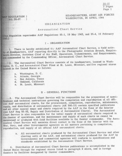
C. Establishment of the Aeronautical Chart Service As a result of a careful analysis of the world situation and broad planning of the military leaders, it was clearly seen that the potential requirements for aeronautical charts would be completely beyond the capabilities of current charting organization. Consequently, there followed Army and Air Force Regulations, establishing the authority and mission of the Map-Chart Division, which on April 26, 1944, was redesignated as the Aeronautical Chart Service. Various regulations which established the Aeronautical Chart Service and set forth its mission: Army Regulations 300-16; AF Regulations 20-37, 85-82 and 20-2 and Headquarters ACS Instructions 20-54. The latter-mentioned Air Force Regulation defined the line of command under which the Aeronautical Chart Service would operate; this was the Reconnaissance Section, Tactical Employment Branch, Requirements Division, AC/AS-3. The Chart Service operated under this authority throughout WWII.
AAF Regulation 20-37, Aeronautical Chart Service (26 April 1944) |
|||||||||||||||||||||||||||||||||||||||||||||||||||||||||||||||||||||||
|
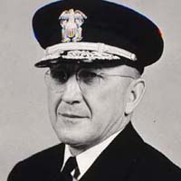
D. St. Louis Aeronautical Chart Plant As previously mentioned, as far back as 1923 the Map-Unit compiled and distributed airport information. This was a continuing function throughout the succeeding years. When aeronautical chart production for the Army Air Forces began in 1941, the collection of airport information, navigational aids and other data for aeronautical overprints on charts became the function of the Map-Chart Division. With the exception of aeronautical charts of the U.S. and Alaska, the compilation of the aeronautical overprint was the responsibility of the Map-Chart Division. The usual procedure was that once the contracted agency compiled and drafter a new base map, it was forwarded to the Map-Chart Division for preparation of the aeronautical overprint. Upon its return to the contracted agency, plates were made and printing started. However, new airfields, navigational aids, radios and signals and other installations were constantly being established, resulting in the need to obsolete the chart and prepare a new edition. It was apparent early in the program that the delays and necessity of reprinting in this manner were inefficient; accordingly, it was proposed that the contracting agencies print base maps without the aeronautical overprint in relatively large quantities and deliver them to an aeronautical chart facility which would carry a stock of base maps and overprint limited quantities, from time to time, with up-to-date aeronautical data as requirements arose. Thus, this facility would concentrate on the aeronautical overprint of already printed maps. In planning such a facility, several considerations were important. It was decided the contemplated facility should be located out of the highly congested and vulnerable East coastal area; it should be placed so as to take maximum advantage of existing rail and express networks for distribution purposes; and probably of greatest importance was that the facility would need to be capable of producing urgent orders for aeronautical charts as a security measure. In order to accomplish this, a facility completely under control of the Army Air Forces was deemed necessary so the work-load of a given geographic area could be undertaken without calling attention to the given area of interest, in compliance with War Department intelligence policy that the very furnishing of maps and charts of a given area could give away secret war plans of future operations. Upon the completion of preliminary studies, the recommendation to establish such a facility was presented in a letter to the Chief of the Army Air Forces on February 19, 1942. General Arnold approved the proposal and planning of the aeronautical chart facility proceeded. Funds were requested and placed in the Sixth Supplemental Estimate E of Fiscal Year 1942. These funds were successfully defended before the Air Forces, War Department and Budgetary Committees and approved by Congress. Immediately following the attack on Pearl Harbor, Air Forces stocks of charts had been seriously depleted as a result of increased activity. A survey of all governmental mapping agencies was made to determine ways of addressing this shortfall. The Hydrographic Office agreed to supply the Air Forces with all nautical charts produced by the Navy, providing the Air Forces planned their requirements in sufficient time to obviate special runs. However, since the Navy could not accommodate the plate size of aeronautical charts prepared by the Coast and Geodetic Survey, it was impossible for them to assist in the printing. The Army Map Service agreed to undertake some of the Air Forces' printing requirements, and the Coast and Geodetic Survey agreed to loan the Army Map Service the plates and color pulls to facilitate production. No notice was ever given by the Bureau of the Budget to stop the charting facility; therefore, planning proceeded. When plans and specifications for a new building had progressed to a point where real estate should be acquired, building material had become so scarce that it was deemed advisable to rent and convert an existing structure. It was then suggested that the Air Force lease a commercial reproduction plant in the Midwest, but a thorough investigation found no suitable commercial facility. In approximately March 1942, in cooperation with representatives of the Bureau of the Budget, the Air Forces explored the possibility of taking over other governmental mapping facilities. It was determined, however, that while the aid of these agencies was desirable, the ordinary procedure of government should not be disrupted by taking them over. During the period of the controversy the preliminaries for the establishment of the aeronautical chart facility proceeded. The first efforts were to secure an existing structure. A new building in the hands of the Continental Can Company was found to be suited to the requirements with only minor alterations necessary. On May 22, 1942, the Director of Photography requested the Corps of Engineers to purchase this building; however, it was learned that the Navy Department, the Quartermaster Corps, the Ordnance Department and the Air National Command were all seeking the same property, which ultimately was acquired by the Quartermaster Corps. As late as September 1942, it was recommended that efforts be made to have the Quartermaster Corps release the Continental Can Company's building. On September 8, 1942, upon a request of the Bureau of the Budget, a conference was called to thoroughly examine the Air Forces requirements for an aeronautical chart facility. This meeting was attended by representatives of the following: Fiscal Division, Air Forces; Directorate of Photography, Maps and Charts, Air Forces; Army Corps of Engineers; Navy; Coast and Geodetic Survey; and the Bureau of the Budget. Historical reports indicate the requirements were thoroughly discussed, and it was unanimously agreed the Air Forces needed an aeronautical chart facility. The details of the proposed facility were discussed meticulously, and when the matter of printing equipment was discussed there were some present who did not concur, and the Bureau of the Budget representative suggested that existing governmental reproduction facilities could be made available to the Air Forces for the duration of the war. This resulted in a long series of formal and informal conferences on the subject of reproduction facilities to be allowed the Air Forces. In the meantime, effort had been made to utilize all available government facilities in whole or in part. In the latter part of 1942, the Army Map Service advised their workload for ground forces was approaching such proportions that assurance could no longer be given the Air Forces that the Army Map Service would be able to satisfy the reproduction needs of the Air Forces for aeronautical charts. Notwithstanding, the objections to the aeronautical chart facility persisted and conferences continued. By December 1942, the controversy had simmered down to the question of the number of presses required. The continual search for a building suitable for conversion resulted in the leasing of the Mid-West Terminal Building in St. Louis, Missouri, and remodeling was scheduled for completion and occupancy by March 1, 1943. On December 31, 1942, the War Production Board issued a Preference Rating Certificate (Rating AA-l), allocating the equipment. This certificate included six presses. In a series of conferences at this time it was stated that while requests were made in some cases for fourteen presses and in others for nine, the Air Force requested six presses as the requirement. During one of these meetings held on January 4, 1943, the Bureau of the Budget stated that it had no objection to the Air Force having two presses: one for printing experimental and development charts and one as a standby for emergency work. The Air Forces representative countered by representing that even six presses would provide only about 10% of their map printing requirements. On January 19, 1943, in an effort to gain an appeal on this matter the Director of Photography addressed a lengthy memorandum to the Director of Technical Services. The memorandum, which reviewed the entire controversy in considerable detail, resulted in a meeting with the Assistant Secretary of War for Air on January 20, 1942. It was agreed that two of the six presses already procured, together with accessory equipment, were an absolute requirement. Written statements were requested from the Army Map Service and the Coast and Geodetic Survey regarding their ability to make available additional printing facilities. These statements indicated that the Army Map Service was unable to guarantee any fixed capacity for Air Force work. While the Coast and Geodetic Survey was agreeable towards putting four presses to work for the Air Forces when required, there was no indication that their presses could be segregated as desired to permit Air Force personnel to control, supervise and expedite work in accordance with military requirements and security regulations. On January 29, 1943, the Secretary of War in a letter addressed to the Director of the Budget (in reply to his letter of January 11th) outlined the above and stated: The fact remains that except for the two presses about which there is no disagreement, the Army Air Forces will have no reproduction facilities upon which absolute control and reliance can be expected for emergency work in the war effort. This is undesirable. However, the procedure as outlined in letter from the Director of Coast and Geodetic Survey, dated January 23, 1942, (Incl #2) will be placed in effect and given a fair trial. If at a future date this procedure fails to provide the necessary equipment to the Army Air Forces or results in delay on projects necessary to the war effort, it will be necessary to review the situation. In the meanwhile, but two of the six presses already delivered will be installed in the St. Louis plant. The Adjutant General officially announced on February 17, 1943 the establishment of the Army Air Forces Aeronautical Chart Plant under AAF Regulation 95-4, dated 15 February 1943. Although the Secretary of War had apparently agreed to the curtailed press equipment and trial of proposed alternative methods, the experience was, seemingly, short lived. Also, the controversy appeared to have been reduced to correspondence between the Secretary of War and the Director of the Budget. Mention is made of letters dated January 11, February 2 and 13 and others, until the Director of the Budget, in a letter to the Secretary of War, dated March 8, 1943, agreed to the installation of these presses based on the information that this number would be required to carry the anticipated load of adding the aeronautical overprint to base maps compiled and printed by other Federal agencies and qualified commercial operators. Subsequent approval of the purchase of equipment by the War Production Board and the Joint Committee on Printing was obtained on an informal basis but not confirmed in writing until January 18, 1944. On June 15, 1943, the Aeronautical Chart Plant, St. Louis, Missouri was activated. Some personnel from Washington had been transferred, and the recruitment of additional personnel was in progress. The first commanding officer of the Aeronautical Chart Plant was Colonel H. Arnold Karo, who was transferred by Executive Order from the Coast and Geodetic Survey to the service and jurisdiction of the U.S. Army Air Forces where he held various assignments. Beginning in June 1943, he was assigned for more than 2 years as Commanding Officer of the Aeronautical Chart Plant in St. Louis, Missouri. After the war he returned to the Coast and Geodetic Survey and was appointed as its director, with the rank of Rear Admiral, by President Eisenhower in 1955.
Admiral H. Arnold Karo Early in 1943, the Aids to Navigation Branch was moved to St. Louis, Missouri at the time of the Aeronautical Chart Plant' s activation. One Air Corps Officer, three WAACs, and three civilians comprised the personnel of the Branch at its beginning. By the end of 1943, personnel strength totaled fifty-five civilians and three officers. Initially, work in the Branch was restricted to recording of air information on reference data cards and the training of new personnel in this comparatively new field. All available information on aerodromes and radio navigation aids was screened, recorded and cross-indexed. During this period, the plotting of aeronautical information on the various chart series was accomplished almost entirely by the Maintenance Sub-Unit of the Production Section. Aeronautical overlays of the plotted information were returned to Aids to Navigation for final edit and possible additions of current information. These work procedures prevailed until April 1944, when the Maintenance Sub-Unit, which was engaged solely in the plotting of aeronautical information, was transferred to the Aids to Navigation Branch, enabling the Branch to finally assume its full responsibilities. As a result of the consolidation, personnel strength totaled 83 civilians and 3 officers.
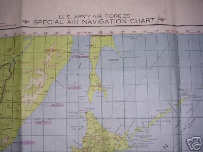
AAF Special Air Navigation Chart Japan 1945 The work products for which Aids to Navigation assumed responsibility in 1943 consisted of:
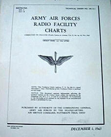
Radio Facility Sheets compiled and published totaled 379 sheets prior to the suspension of this project in November 1943. A complete revision of the Airport Directory was completed December 1943, requiring the recompilation of information on 2,929 airfields. During the period July 1943 to June 1944, one hundred and twenty-five Chart Correction Notices and 1,633 aeronautical overlays were compiled. The processing of aeronautical information continually increased, with the result that current information was available on approximately 26,500 airfields and 14,000 radio facilities throughout the world.
AAF Radio Facility Charts (1943) In February 1945, the compilation and publication of the Chart Correction Notice was discontinued. The Airport Directory was in its third revision, and the compilation of aeronautical overlays remained a primary project. The Branch received its first Domestic Pilot?s Handbook for edit of aeronautical information and preparation for publication in April 1945. By July, the Branch assumed responsibility for compilation of aeronautical information on all Instrument Approach and Landing Charts of the U.S., consisting of 8 handbooks. September to November 1945 saw the complete program, excepting reproduction, transferred to the Branch, with the additional responsibilities of base compilations, authority to revise charts, publication of indices and lists, computation of Sunrise and Sunset Tables, and the initiation of the new series Instrument Landing System (ILS) Charts. Because of time lost in forwarding completed compilations to Washington, D. C., for printing, the Government Printing Office contracted a St. Louis firm to accomplish the printing of this chart series. Revision of the Airport Directory of the Continental U. S. was suspended October 1945. The following figures represent the wartime printing workload of the St. Louis Aeronautical Chart Plant:
The below table depicts the personnel working at the St. Louis Aeronautical Chart Plant.
|
|||||||||||||||||||||||||||||||||||||||||||||||||||||||||||||||||||||||
|
Having made immense contributions to the development and production of aeronautical charts and information during WWII, the Aeronautical Chart Service demonstrated its vital role of providing the armed forces and the commercial air transportation industry, accordingly the chart service was retained after WWII. The Aeronautical Chart Service was withdrawn from Headquarters Army Air Forces and placed under the command of the Air Transport Command in April 1946. Subsequently on May 26, 1947, by Air Transport Command General Orders No. 21, the Chart Service was placed under the jurisdiction of Strategic Air Command, Andrews Field, Camp Springs, Maryland. However, on 1 March 1950, the Aeronautical Chart Service was transferred from the Strategic Air Command and placed under Air Materiel Command, Wright- Patterson Air Force Base, Dayton, Ohio. Finally pursuant to General Orders No. 11, Headquarters Air Materiel Command, dated February 14, 1951, the nomenclature of the USAF Aeronautical Chart Service was changed to USAF Aeronautical Chart and Information Service. This change in designation reflected new responsibilities: to obtain and furnish all aeronautical information used by the Air Force. To implement this work a new Aeronautical Information Division in Headquarters, Aeronautical Chart Information Service, was established February 21,1951, which designated Aids to Navigation Section as the Air Information Division. The Aeronautical Chart Service later became part of the Defense Mapping Agency in 1972, which became part of the National Imagery and Mapping Agency in 1996, whose name was changed in 2003 to its present name, the National Geospatial-Intelligence Agency (NGA). NGA continues the proud history of providing the military services with the finest aeronautical information available.
(The above text was edited from Alford H. Burton, Conquerors of the Airways: A Brief History of the USAF--ACIC and Aeronautical Charts, June 1953, publication of the US Air Force Aeronautical Chart and Information Center, St. Louis, MO. ) |
|||||||||||||||||||||||||||||||||||||||||||||||||||||||||||||||||||||||
|
|
|||||||||||||||||||||||||||||||||||||||||||||||||||||||||||||||||||||||
|
© Copyright 2008. All rights reserved. |